Local Tangent Plane Coordinates (LTP)
Saw this in MIT-PITT-RW.
LTP is a local, earth-centered Cartesian coordinate system that approximates a flat plane tangent to the Earth’s surface at a specific location.
They use this frame. They use the “ltp” frame instead of the odom/ map frame that I use. Really interesting.
- Ahhh it makes total sense
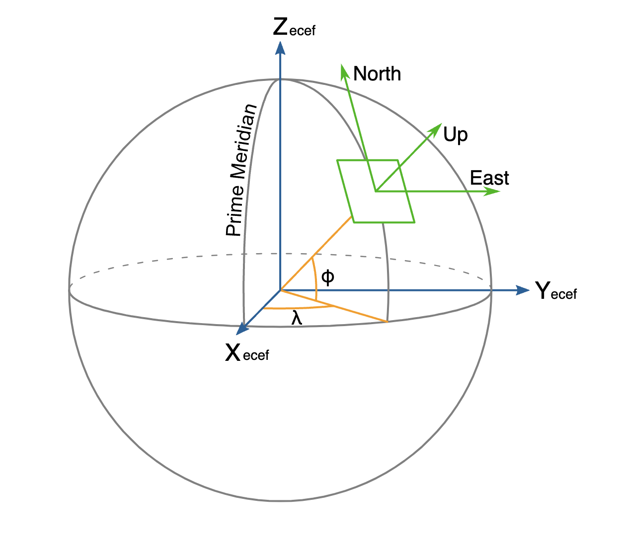
- So usually our LTP frame is just the
odom/mapframe
The problem
The problem is that if we use the ECEF frame directly (without
odom, thenearthis center of earth. transforms done with earth to odom frame, since the distance is >6000 km.Therefore, LTP serves as an intermediary frame.
Local Tangent Plane (ENU or NED): To bridge the vast distance between the Earth frame and the odom frame, an intermediary local tangent plane is used, typically ENU (East-North-Up) or NED (North-East-Down).
ENU = earth-north-up frame NED = north-east-down frame